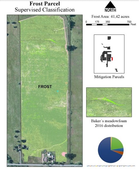
AerialZeus LLC demonstrated the efficiency and effectiveness of aerial mapping of threatened and endangered species in conjunction with a long-term mitigation monitoring plan for the Willits Bypass Project Off-site mitigation areas. This project served to satisfy Year 2 vegetation performance monitoring requirements for rehabilitated wetland mitigation areas that are managed for the benefit of Baker’s meadowfoam (Limanthes bakeri). This habitat mapping effort was part of the Willits Bypass Off-site Mitigation Project, completed for the California Transportation Department (CALTRANS).
In this project, the AerialZeus team conducted field monitoring activities using unmanned aircraft systems (UAS) and multispectral sensors, using a combination of remote sensing techniques to perform selective vegetation mapping.