The natural resources on which life depends are changing rapidly. Increased flooding, wildfires, crop and forest damage, pests, all are visible testimony to the changes underway in natural systems. Remote sensing capabilities allow rapid and repeated documentation of these changes, their extent, frequency and impact. Soil stability, urban greening and tree canopies, carbon farming and methane monitoring – these are just some of the ways to better understand, prepare for and/or mitigate—the impact of these changes. Mitigation actions verified over time can also reap long-term resource, climate, community and financial benefits for their sponsors and participants.
Our Services
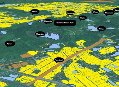
GIS for Natural Resources
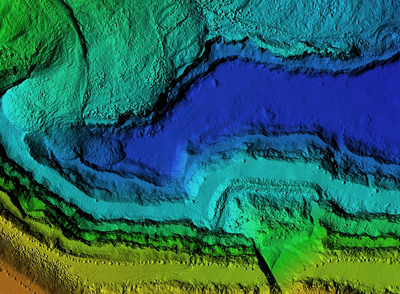
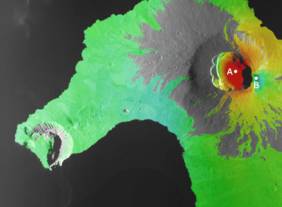
Digital Landscape and Elevation Models (LiDAR)
Natural Resources & Habitat Assessment
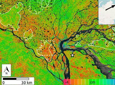
Ground Deformation (SAR/InSAR)
Capabilities
- Renewable energy site assessments
- Soil stability analysis is high-risk locations
- Vegetation management practices assessment & verification
- Methane, C02 and air toxics monitoring
- Urban forestry – inventories, canopy assessment and growth plans
- Verification of habitat conditions over time